
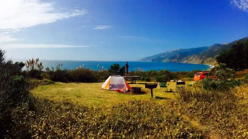
Big Sur Dispersed Camping: Legal Areas, Rules and Alternatives
Big Sur dispersed camping is not legal at every scenic pullout, beach, or dirt road. Potential camping can exist on specific public lands, especially Los Padres National Forest, but access changes with Forest Orders, wildfire closures, road conditions, fire restrictions, and private property. Verify the exact parcel and current agency rules before leaving home.
Current conditions alert — September 11, 2026: This is not a normal time to plan dispersed camping in the affected Monterey Ranger District. Los Padres National Forest currently lists Emergency Closure Order 05-07-51-26-10 for the Timber and Plaskett Fire area. The Forest Service says the order closes the affected National Forest lands, roads, and trails identified in the order and map.
The Plaskett Fire was listed at 29,918 acres and 73% contained in the latest CAL FIRE update available from September 10, while the Timber Fire was listed at 25,380 acres and 27% contained. Active evacuation orders and warnings remained in parts of the region.
Caltrans was also reporting Highway 1 closed from 10.5 miles to 19 miles north of the San Luis Obispo/Monterey County line near Kirk Creek because of wildfire activity. Conditions can change quickly, so check again immediately before travel.
Table of Contents
Big Sur Dispersed Camping at a Glance
| Planning Question | What to Know |
|---|---|
| Can you camp at any Highway 1 pullout? | No |
| Main federal land manager for many inland mountain areas | Los Padres National Forest |
| Are famous ridge areas currently reliable camping options? | No; current emergency closures affect the region |
| Reservations for ordinary dispersed camping | Usually not the main system, but camping must still be legal and the area open |
| Toilets and water | Do not assume either is available |
| Campfires | Controlled by current fire restrictions and closure orders |
| Road access | Often primitive and condition-dependent |
| Cell service | Do not rely on it |
| Best backup | A confirmed open developed campground or another verified public-land area |
The most important rule is simple: a campsite pin is not permission to camp.
A location can appear on an app, blog, or old map while being closed, privately owned, inaccessible, or subject to a current Forest Order.
Is Big Sur Dispersed Camping Legal?
It can be legal on some public land when the area is open and the responsible agency permits it. But “Big Sur” is a region, not one campground or one public-land unit.
The coastline and mountains include a mixture of:
- Los Padres National Forest
- California State Parks
- Public roads
- Developed recreation sites
- Wilderness
- Private property
- Areas affected by temporary emergency orders
That means you cannot apply one camping rule to every dirt road or turnout.
Dispersed Camping vs. Developed Camping
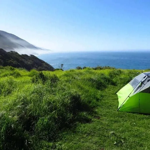
Dispersed camping usually means camping outside a developed campground. You should not expect numbered sites, reservations, restrooms, potable water, trash collection, picnic tables, or RV hookups.
A developed campground such as Kirk Creek or Plaskett Creek is different. These are established Forest Service campgrounds with designated campsites and facilities, even though they may be relatively simple.
Dispersed Camping vs. Big Sur Backcountry Camping
Vehicle-access dispersed camping is also different from backcountry camping.
Backcountry camping generally involves hiking to a campsite or wilderness area. Vehicle restrictions, trail closures, fire rules, water planning, and wilderness regulations may be very different.
During the current wildfire emergency, State Parks says backcountry trails east of Highway 1 in the affected Big Sur parks remain closed, and the Forest Service emergency closure also affects large portions of the Monterey Ranger District.
Do not treat a backpacking camp as a replacement for a closed roadside dispersed site without planning an entirely different trip.
Current Big Sur Dispersed Camping Conditions
As of September 11, 2026, the safest planning assumption is that the well-known South Coast National Forest routes affected by the Timber and Plaskett Fire emergency should not be treated as available recreational camping areas.
Forest Service Alert Order 05-07-51-26-10, which began August 29, superseded an earlier closure order and remains listed as an active Monterey Ranger District emergency closure.
Prewitt Ridge and South Coast Ridge Area
Prewitt Ridge has long appeared in online free-camping guides, but that history is not evidence of current access.
The Plaskett Fire response has used Prewitt Ridge and South Coast Ridge Road as operational and containment features. Current wildfire and Forest Service closure information means travelers should not attempt recreational access into closed fire areas.
When the emergency is eventually lifted, start again with the Forest Service—not an old campsite coordinate—to determine whether camping and motorized access are permitted.
Plaskett Ridge Area
The Plaskett area is directly associated with the active Plaskett Fire, which began near Forest Road 23S10 east of Los Burros Road.
Do not use old reports of Plaskett Ridge camping as current access guidance. The fire remains active, and portions of Monterey County remain under evacuation orders or warnings.
Los Burros Road and Nearby Ridge Roads
Los Burros Road has also been part of the wildfire response area. Earlier incident reports described structure protection and firefighting activity along the road.
The correct question is therefore not “Can my vehicle reach the campsite?” It is first:
Is recreational entry currently permitted at all?
If the answer is no, vehicle capability becomes irrelevant.
Why This Guide Does Not Publish “Secret” GPS Campsites
Exact campsite pins can create several problems in a place like Big Sur:
- Land ownership can change across short distances.
- A pin can accidentally fall on private land.
- Emergency orders can close an otherwise legal area.
- Access roads can become impassable.
- Visitors can create new disturbed sites around a popular coordinate.
- A campsite visible on an old map may no longer be legal.
A legal-camping guide should help you verify a site, not encourage you to bypass that verification.
How to Verify a Big Sur Campsite Before You Drive There
Use the same process every time, even if you have camped in the area before.
Step 1: Identify the Land Manager
First establish exactly who manages the parcel.
Is it:
- U.S. Forest Service?
- California State Parks?
- BLM?
- County or other local land?
- Private property?
Do not assume a dirt road through forested mountains is automatically National Forest land.
The same land-manager-first process applies elsewhere in the West; our guide to finding legal dispersed camping on public land shows how Forest Service, BLM, and state rules can differ.
Step 2: Check Current Forest Orders and Alerts
For Los Padres National Forest, check the official Alerts page—not only the general recreation description.
As of September 11, 2026, that page includes:
- Monterey Ranger District Emergency Closure Order #05-07-51-26-10.
- Forest-wide Fire Use and Firearm Restrictions #05-07-00-26-05.
- Occupancy and Use Order #05-07-00-26-02.
- A separate prohibition on roadside camping along part of Nacimiento-Fergusson Road.
An emergency closure overrides your normal camping plans.
Step 3: Check Official Road and Motor-Vehicle Information
A legal camping area may still be inaccessible by vehicle.
Use Forest Service motor-vehicle and road information to determine:
- Which roads are open to your type of vehicle.
- Whether motorized travel is allowed.
- Whether seasonal or emergency gates are closed.
- Whether a road is inside an active closure.
A line shown on a navigation app does not prove that a road is open to public motor vehicles.
Step 4: Check Highway 1
Highway 1 is the backbone of most Big Sur travel.
On September 10, 2026, Caltrans listed the wildfire closure between approximately 10.5 and 19 miles north of the San Luis Obispo/Monterey County line, with the northern closure near Kirk Creek Campground.
Never plan the last few miles of an access route without checking the highway first.
Step 5: Check Fire Restrictions
Los Padres National Forest currently lists Fire Use and Firearm Restrictions under Forest Order 05-07-00-26-05, effective from June 4, 2026. The Forest Service alert states that fires, campfires, and stove fires are prohibited outside designated campfire-use sites, subject to the order’s stated exceptions.
A California Campfire Permit is not permission to ignore a Forest Order or emergency closure.
Always read the current restriction before using any flame or stove.
Step 6: Confirm Private Property Boundaries
The Big Sur mountains contain both public and private parcels.
Do not:
- Cross locked gates.
- Drive around barriers.
- Enter signed private property.
- Assume an old road crossing private land gives you public access.
If you cannot confirm legal access, choose another location.
Step 7: Save a Legal Backup
Wildfire, road damage, weather, full sites, or new restrictions can eliminate your first choice after you have already started the trip.
Prepare at least one backup that you have independently confirmed is:
- Open.
- Legal for overnight camping.
- Reachable by your vehicle.
- Suitable for your setup.
If Big Sur is one stop on a longer trip, our road trip camping planning guide explains how to build backup campsites and rerouting options into the itinerary before you leave.
Why Current Road and Wildfire Conditions Matter More Than Old Lists
Big Sur access can change faster than an article or campsite database can be updated.
The Plaskett Fire remains active. The latest official information available from September 10 lists it at 29,918 acres and 73% containment. The Timber Fire also remains active at 25,380 acres and 27% containment.
Containment percentage also does not mean a recreation area is open.
Emergency managers may keep roads, forests, parks, and trails closed because of:
- Active fire.
- Falling trees.
- Burned slopes.
- Rockfall.
- Damaged roads.
- Firefighting operations.
- Utility work.
- Post-fire rehabilitation.
For that reason, do not assume an area becomes a camping option simply because wildfire containment improves.
Big Sur Camping Rules to Check Every Time
Stay Limits
Do not automatically apply a generic “14-day rule” to every campsite.
Los Padres National Forest currently maintains a specific Occupancy and Use Forest Order #05-07-00-26-02 covering camping stay limits. Check the current order for the exact area after the emergency closure is lifted.
Nacimiento-Fergusson Road Has a Separate Camping Restriction
Even after broader fire closures change, a separate Forest Service order is important for campers to know.
Camping is prohibited within 300 feet of Nacimiento-Fergusson Road for the first 12 miles east of its Highway 1 intersection. The order is effective through September 5, 2027.
That makes roadside pullouts along that section inappropriate camping substitutes.
Campfires and Stoves
Never assume a fire ring means a fire is currently legal.
Los Padres currently has forest-wide fire-use restrictions, while active wildfire closures create an additional reason to avoid the affected backcountry altogether.
Check:
- Whether the area is open.
- Whether fires are allowed there.
- Whether your type of stove is permitted.
- Whether a California Campfire Permit is required.
Water
Treat dispersed camps as having no reliable potable water unless an official source specifically confirms otherwise.
Carry enough water for drinking, cooking, cleaning, and emergencies. Do not plan your supply around an unnamed spring shown on an old map.
Trash and Human Waste
Dispersed camps generally lack trash service.
Pack out everything you bring. Follow the land manager’s current sanitation requirements for human waste, and use toilets where required or available.
Use Existing Disturbed Areas
When dispersed camping becomes legal again, favor an existing impacted site rather than clearing vegetation or enlarging a campsite.
Avoid driving or pitching tents on undisturbed vegetation.
Do Not Assume Beaches Are Free Campsites
Free camping Big Sur searches frequently lead travelers toward coastal pullouts and beach areas.
That can be misleading.
Los Padres currently maintains a separate order prohibiting overnight camping on San Carpoforo Beach, demonstrating why individual coastal areas must be checked rather than treated as open public shoreline camping.
Road Access: Is Your Vehicle Suitable?
When an area is legally open, the next question is whether your vehicle belongs on the road.
Big Sur forest roads can involve:
- Loose surfaces.
- Deep ruts.
- Steep grades.
- Narrow sections.
- Limited turnaround space.
- Washouts.
- Mud after storms.
- Rockfall.
- Exposed edges.
Large RVs and trailers require even more caution.
Do not interpret “4WD recommended” as a challenge to see how far a passenger car can get. Likewise, having four-wheel drive does not make a closed or damaged road legal or safe.
Try to reach unfamiliar dispersed areas with substantial daylight remaining. If road conditions become worse than expected, turn around while you still have a safe opportunity.
Never drive around a locked gate or emergency barrier.
What to Expect at a Dispersed Campsite
A true dispersed campsite normally offers far less infrastructure than a developed campground.
Plan for:
- No drinking water.
- No toilet.
- No trash collection.
- No campsite host.
- No electrical hookups.
- No sewer hookup.
- No guaranteed level parking.
- Limited or absent cell coverage.
- No guaranteed vacant site.
That makes self-sufficiency essential.
Carry offline navigation, extra water, suitable clothing, basic emergency supplies, and a way to manage waste legally.
For remote travel, tell someone where you plan to go and when you expect to return.
Free Camping Big Sur: What “Free” Really Means
When a legal dispersed site has no nightly fee, “free” only describes the campsite charge.
It does not mean:
- Camp anywhere you want.
- Stay indefinitely.
- Ignore private land.
- Ignore Forest Orders.
- Drive wherever you want.
- Have a campfire automatically.
- Receive water or toilet service.
- Get a reserved campsite.
- Receive road maintenance suitable for every vehicle.
The lack of a fee comes with more responsibility, not fewer rules.
Big Sur Camping Alternatives When Dispersed Areas Are Closed
During the current wildfire emergency, several usual Big Sur alternatives are themselves affected. Verify each one immediately before planning a trip.
Kirk Creek Campground
Kirk Creek is a developed Los Padres National Forest campground on the coast. Under normal operations, Recreation.gov lists tent and RV camping, vault toilets, and no utility hookups or onsite water.
However, Recreation.gov currently displays a wildfire warning telling visitors not to visit until the location is deemed safe, and Highway 1 remains closed near Kirk Creek. It should not be treated as a current backup campsite on September 11, 2026.
Plaskett Creek Campground
Plaskett Creek is another developed Los Padres campground near Sand Dollar Beach. Recreation.gov normally lists individual and group sites for tents and RVs, without utility hookups.
Its current listing also carries Highway 1 and facility notices, while the surrounding area is directly affected by the Plaskett Fire emergency. Verify reopening and road access before making it part of a future trip.
Pfeiffer Big Sur State Park
Pfeiffer Big Sur State Park normally provides one of the major developed camping options in the region.
But California State Parks currently lists the park as closed due to the Timber Fire, with the closure in place until further notice.
Do not rely on future reservation availability shown by a booking calendar as proof that the park has reopened from an emergency closure. Always check the park’s current restrictions first.
Williams Hill Recreation Area
If the goal is legal public-land camping rather than camping directly on the Big Sur coast, Williams Hill Recreation Area is a separate inland BLM option in southern Monterey County.
BLM currently lists:
- Developed campsites.
- Dispersed camping on undeveloped public lands not closed to camping.
- No camping fee.
- A maximum total stay of 14 days during any three-month period.
- No electricity.
- No running water.
- No trash collection.
- Vehicle use limited to designated open routes.
Williams Hill is not a coastal Big Sur campsite and should not be presented as one.
It also falls under current Central Coast Field Office fire restrictions. BLM says that, under the restrictions effective May 15, 2026, campfires and charcoal or stove fires are not allowed outside agency-provided fire rings or barbecues at designated developed recreation sites.
Check both the Williams Hill page and current BLM fire restrictions before traveling.
Big Sur Backcountry Camping Is a Different Trip
Backcountry camping requires a separate plan from vehicle-based dispersed camping near Big Sur.
You may need to consider:
- Trail access.
- Wilderness boundaries.
- Water sources.
- Stream conditions.
- Trail damage.
- Fire closures.
- Food storage.
- Navigation.
- Overnight regulations.
Right now, this distinction is even more important because the Timber and Plaskett Fires have caused major backcountry closures.
California State Parks says its affected backcountry trails east of Highway 1 remain closed because of ongoing fire suppression and repair work.
Wait for official reopening information rather than using hiking routes to work around a vehicle-access closure.
Big Sur Dispersed Camping Trip Checklist
Before leaving home, confirm each item:
- Exact land manager identified.
- Overnight camping confirmed as legal.
- Current Forest Orders checked.
- Wildfire closures checked.
- Evacuation orders checked.
- Forest road access checked.
- Highway 1 conditions checked.
- Current fire and stove restrictions checked.
- Private-property boundaries checked.
- Vehicle is appropriate for the road.
- Weather checked.
- Drinking water packed.
- Toilet and waste plan prepared.
- Trash will be packed out.
- Offline map downloaded.
- Campsite can be reached before dark.
- A second legal overnight location is ready.
If one of the first five items is uncertain, do not proceed to the campsite.
Common Mistakes to Avoid
Trusting an Old GPS Pin
A coordinate tells you where something is. It does not tell you whether camping there is legal today.
Sleeping at a Highway 1 Pullout
A scenic turnout is not automatically an overnight campsite.
Verify the exact parking and camping rules rather than assuming roadside access equals camping permission.
Assuming Public Land Means Open Land
Federal land can be temporarily closed by fire, storm damage, resource protection, or another Forest Order.
Driving Around a Gate
A closed gate is not an invitation to search for another way around.
Ignoring Private Parcels
Mixed ownership is common in rural California. Confirm boundaries before entering side roads.
Assuming a Campfire Permit Overrides Restrictions
It does not.
Current Forest Orders, fire restrictions, and emergency closures control what is actually allowed.
Taking the Wrong Vehicle
A legal site can still be unsuitable for a low-clearance car, long trailer, or large motorhome.
Arriving After Dark
Unfamiliar primitive roads become harder to assess when you cannot see road edges, ruts, obstacles, or safe turnaround areas.
Depending on Cell Service
Download the information you need before leaving reliable coverage.
Having No Backup
If your only plan is a single free campsite pin, you do not have a complete Big Sur camping plan.
Frequently Asked Questions
Is Big Sur dispersed camping currently allowed?
As of September 11, 2026, big sur dispersed camping should not be planned within the active Monterey Ranger District Timber and Plaskett Fire emergency closure area. Forest Service Order 05-07-51-26-10 remains listed as active. Check the official Los Padres National Forest Alerts page immediately before any future trip because reopening conditions can change.
Can you camp for free along Highway 1 in Big Sur?
Do not assume Highway 1 pullouts, beaches, or roadside parking areas are legal overnight campsites. Camping permission depends on the exact land manager and any local or federal restrictions. Some areas have explicit prohibitions, including the current roadside camping restriction along part of Nacimiento-Fergusson Road.
Is Prewitt Ridge open for camping?
Do not treat Prewitt Ridge as an available camping destination during the current September 2026 emergency. The ridge has been involved in Plaskett Fire suppression operations, and the Monterey Ranger District has an active emergency closure covering the Timber and Plaskett Fire area. Check the Forest Service’s current closure map and alerts before any future attempt to visit.
Do you need a permit for dispersed camping in Los Padres National Forest?
The requirements depend on the location and activity. A California Campfire Permit relates to fire or stove use where those activities are otherwise allowed; it does not give permission to enter a closed area or override current fire restrictions. Los Padres also maintains separate Forest Orders for occupancy, fire use, and area closures.
What should you do if dispersed camping near Big Sur is closed?
Do not improvise by sleeping at a highway pullout, beach, or closed forest road. Look for a confirmed-open developed campground or another public-land area where camping is specifically allowed. During the current fires, even usual Big Sur alternatives such as Kirk Creek and Pfeiffer Big Sur are affected, so verify every backup before driving there.
Conclusion
For Big Sur dispersed camping, the safest planning order is:
land manager → current closure → road access → fire rules → legal campsite → backup
That order matters more than an old campsite pin or scenic photo.
As of September 11, 2026, the Timber and Plaskett Fires continue to affect the region, Highway 1 remains partially closed near Kirk Creek, and major recreation areas remain under emergency restrictions. Delay access to closed areas and perform one final check of Forest Service, Caltrans, wildfire, and campground information immediately before any future Big Sur camping trip.
References:
- U.S. Forest Service — Los Padres National Forest Alerts
Includes the Monterey Ranger District Emergency Closure Order, Fire Use and Firearm Restrictions, Occupancy and Use Order, and other active alerts. Los Padres National Forest Alerts - U.S. Forest Service — Roadside Camping Prohibited: Nacimiento-Fergusson Road
Current Forest Order prohibiting camping within 300 feet of the first 12 miles of Nacimiento-Fergusson Road east of Highway 1. Nacimiento-Fergusson Road camping restriction - CAL FIRE — Plaskett Fire
Current acreage, containment, evacuation information, and incident updates. Plaskett Fire incident page - CAL FIRE — Timber Fire
Current acreage, containment, evacuation information, and incident updates. Timber Fire incident page - Caltrans — State Route 1 Road Conditions
Current Highway 1 wildfire closure and traffic restrictions. Caltrans Highway 1 conditions - California State Parks — Pfeiffer Big Sur State Park
Current wildfire closure and Big Sur park restrictions. Pfeiffer Big Sur State Park - Recreation.gov — Kirk Creek Campground
Campground facilities and current wildfire notice. Kirk Creek Campground - Recreation.gov — Plaskett Creek Campground
Campground facilities and current access/facility notices. Plaskett Creek Campground - Bureau of Land Management — Williams Hill
Camping availability, stay limit, facilities, vehicle rules, and fees. Williams Hill Recreation Area - Bureau of Land Management — Central Coast Field Office Seasonal Fire Restrictions
Current fire restrictions effective May 15, 2026. BLM Central Coast fire restrictions