
Gordon Gulch Dispersed Camping Area CO: Map, Access and Rules
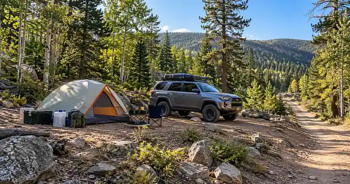
Gordon Gulch is a designated dispersed camping area in the Boulder Ranger District of Roosevelt National Forest, north of Nederland, Colorado. Unlike open dispersed camping where you search for any legal previously disturbed spot, Gordon Gulch uses 15 numbered designated campsites, available on a first-come, first-served basis.
The most important thing to know before visiting the Gordon Gulch dispersed camping area CO is that the official campsite map, current Motor Vehicle Use Map, road conditions, and fire restrictions all matter. Do not rely only on an old campsite pin or a previous camper’s description.
Table of Contents
Gordon Gulch Dispersed Camping Area CO at a Glance
| Planning detail | Gordon Gulch |
|---|---|
| Land manager | U.S. Forest Service |
| National forest | Roosevelt National Forest |
| Ranger district | Boulder Ranger District |
| Camping type | Designated dispersed camping |
| Designated campsites | 15 numbered sites |
| Reservations | None |
| Availability | First-come, first-served |
| Fee | Generally reported as no-fee; confirm current status before departure |
| Main access | Forest-road network east of Colorado Highway 72 |
| Potable water | Do not expect potable water |
| Restrooms | Do not expect restrooms |
| Trash service | Pack out all trash |
| Fire rules | Depend on current Forest Service restrictions |
| Navigation | Official Gordon Gulch map + current MVUM |
| Best approach | Self-sufficient camping with a backup site planned |
The Gordon Gulch dispersed camping area CO is not a developed campground. You should not expect hookups, campground hosts, showers, potable water, or a reservation system.
That primitive setup is part of its appeal, but it also means trip planning matters more than at a developed campground.
Where Is Gordon Gulch Camping?
Gordon Gulch is located about five miles north of Nederland along the Peak-to-Peak corridor in western Boulder County. The camping area sits within the Boulder Ranger District of the Arapaho and Roosevelt National Forests.
The numbered sites are spread along an unpaved Forest Service road network east of Colorado Highway 72 rather than arranged in a traditional campground loop.
Nederland is the practical gateway town for most visitors approaching from the south. It is a useful place to handle fuel, water, groceries, and other supplies before heading onto the Forest Service roads.
Do not assume that proximity to Nederland means suburban road conditions. Once you leave the highway, the condition of individual forest roads can change considerably with weather, erosion, mud, snow, fallen trees, and maintenance.
Gordon Gulch Dispersed Camping Area CO Map and Site Layout
The official Gordon Gulch map is one of the most useful tools for planning your stay. It identifies 15 numbered designated campsites, roads through the area, gates, private property, and surrounding Forest Service land.
Most importantly, the map states that camping within the mapped Gordon Gulch area is allowed at the designated numbered campsites only.
Understanding the Official Gordon Gulch Campsite Map
The map shows campsites numbered 1 through 15 around Forest Service roads including NFSR 226.1 and connecting roads in the Gordon Gulch network.
It also marks private or non-federal property. That distinction matters because public-road access does not give you permission to camp on adjacent private land.
Another important detail is printed directly on the Forest Service map: it is intended for display purposes rather than navigation.
Use it to understand the campsite layout, but pair it with a navigation resource designed to show legal motorized routes.
Gordon Gulch Campsite Map vs. the MVUM
Two maps serve different purposes at the Gordon Gulch dispersed camping area CO.
The Gordon Gulch campsite map helps you understand where the numbered sites are located and where private-property boundaries appear.
The Motor Vehicle Use Map, or MVUM, identifies roads and trails that are legally designated for motorized travel and indicates the types of motor vehicles permitted on particular routes.
Saving both maps offline is a practical approach because mobile service should never be assumed in a dispersed camping area.
A campsite marker in a third-party app is not proof that camping there is currently legal. Official maps, posted signs, gates, closures, and Forest Service orders take priority over historical pins or user-submitted coordinates.
Are There Unnumbered Campsites at Gordon Gulch?
You may encounter older reviews or campsite apps describing unnumbered camping farther into the forest-road network.
That information should not be treated as permission to camp outside the current designated area.
For the Gordon Gulch dispersed camping area CO itself, follow the Forest Service map and current signs directing visitors to the 15 numbered sites. If you want to camp elsewhere on National Forest land, verify separately that the location and access route are currently legal.
How to Reach Gordon Gulch Dispersed Camping Area CO
The general approach is from Colorado Highway 72 north of Nederland, followed by the Forest Service road network entering Gordon Gulch.
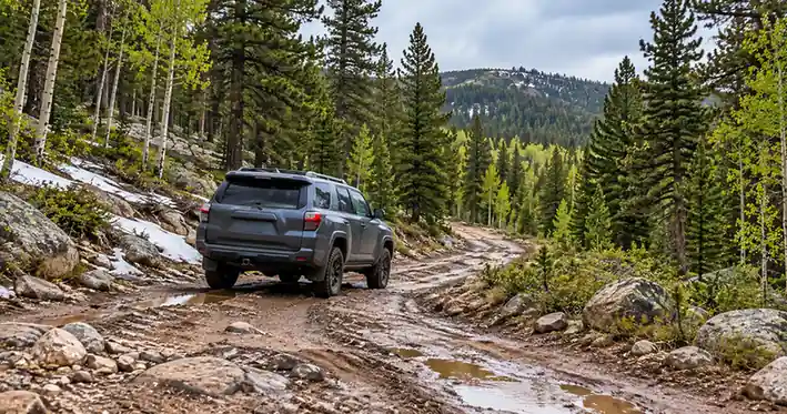
Once you leave the maintained highway, expect unpaved forest roads rather than campground pavement.
Download your maps before leaving reliable service and identify the numbered sites you are interested in, but remain prepared to change plans if a road or campsite does not suit your vehicle.
Gordon Gulch Road Conditions
Road conditions are one of the hardest parts of Gordon Gulch camping to predict accurately.
The Forest Service warns that road conditions can change from season to season and even from one day to the next. Rain or melting snow can create mud, erosion can deepen ruts, and fallen trees or rocks can affect a road that was previously straightforward.
An “open” road is therefore not automatically an easy road.
For the Gordon Gulch dispersed camping area CO, evaluate conditions based on what you actually encounter. If the road surface deteriorates beyond your vehicle’s clearance or your driving experience, turning around is a better choice than damaging the road or vehicle.
Avoid driving around muddy or rocky sections through vegetation. Creating a new bypass damages the surrounding land and can widen the impact of an already rough road.
Do You Need 4WD or High Clearance?
There is no reliable universal answer that every Gordon Gulch visitor needs 4WD, nor is it responsible to promise that every site can be reached in a normal low-clearance car.
Vehicle suitability depends on:
- The numbered site you are trying to reach.
- The exact Forest Service roads you use.
- Recent rain or snow.
- Rut depth and exposed rocks.
- Vehicle ground clearance.
- Tire condition.
- Vehicle length and wheelbase.
- Driver experience.
- Available turnaround space.
Some camper reports describe reaching parts of the area in ordinary vehicles, while others recommend additional clearance for rougher sections.
Treat those reports as snapshots from a particular trip, not permanent road ratings.
RVs, Vans and Trailers
Vans and smaller camping vehicles may find suitable sites, but larger RVs and trailers require more caution.
The official Gordon Gulch map does not provide a complete site-by-site table of parking-spur length, turning radius, slope, or maximum RV size.
That makes it difficult to guarantee that a particular numbered site will accommodate a specific rig.
If you are towing, consider not only whether the road is technically passable but whether you can:
- Turn around if the site is occupied.
- Pass an oncoming vehicle safely.
- Clear dips and rocks without dragging.
- Park entirely within the existing disturbed campsite.
- Leave without damaging vegetation or getting stuck after rain.
Larger rigs should have an alternative destination with known vehicle dimensions rather than depending entirely on Gordon Gulch.
Gordon Gulch Dispersed Camping Area CO Rules and Stay Limits
Gordon Gulch is dispersed camping, but it is regulated dispersed camping. The absence of a traditional campground entrance does not mean there are no rules.
Camp Only in Designated Sites
The most important Gordon Gulch rule is simple: use the numbered designated campsites.
The official map identifies sites 1 through 15 and states that they are first-come, first-served.
If all 15 legal sites are occupied, do not create a new clearing, widen a pullout, move onto vegetation, or assume that an old fire ring makes an unofficial location legal.
Move to a legal backup camping area instead.
Stay Limits
Forest Service dispersed-camping rules generally limit how long visitors can occupy one location. Gordon Gulch planning information commonly uses a maximum of 14 consecutive days at one site, followed by relocation.
Because Forest Orders and occupancy rules can change, anyone considering an extended stay should verify the current Boulder Ranger District limit before setting up for a long period.
For a typical weekend or short camping trip, the more immediate issue is respecting the designated-site boundary and not holding an unoccupied site improperly.
Private Property and Vehicle Travel
The official Gordon Gulch map shows private property within and around the broader road network.
Stay on legal public routes, respect gates and posted boundaries, and do not assume that an open-looking meadow or side road belongs to the National Forest.
Motor vehicles should remain on routes where motorized use is legal. The current MVUM is the best map for determining those route designations.
Trash, Human Waste and Washing
Gordon Gulch requires a self-sufficient approach to sanitation.
The Forest Service’s Gordon Gulch guidance tells campers to:
- Pack out all trash.
- Bury human waste in a cathole about 8 inches deep.
- Keep catholes at least 200 feet from water.
- Conduct washing at least 200 feet from water sources.
- Respect private property.
- Minimize noise.
- Avoid cutting standing trees, whether living or dead.
Where packing out human waste is practical, it can further reduce impacts in a popular dispersed area.
Bring enough trash bags and sanitation supplies for the entire trip rather than expecting a dumpster or restroom on arrival.
Campfires and Current Fire Restrictions
Fire regulations deserve a separate check immediately before every Gordon Gulch trip.
The permanent Gordon Gulch map says campfires are allowed only when fire restrictions are not in effect. Temporary Forest Service restrictions can override that normal guidance.
As of September 26, 2026, active Stage 1 fire restrictions apply to the Boulder Ranger District. Under those restrictions, ordinary open campfires at a primitive dispersed site such as Gordon Gulch are not permitted. Properly operated liquid- or gas-fueled devices with an on/off control may be allowed when used according to the current restriction order.
Do not assume that an old rock ring or existing fire scar means a wood fire is legal.
Fire rules can change quickly with weather and wildfire conditions, so recheck the Forest Service alerts on the day you leave.
A propane camping stove with a positive shutoff is a practical cooking fallback when current restrictions allow it.
Water, Toilets and Other Facilities
Plan for the Gordon Gulch dispersed camping area CO as a primitive, self-contained camping experience.
Do not arrive expecting potable water. Bring enough water for drinking, cooking, cleanup, and your safety margin.
Do not rely on a restroom being available. Bring an appropriate human-waste system and follow the current Forest Service sanitation requirements.
There is also no reason to expect routine trash collection at your campsite. Everything you bring in should leave with you.
Cellular coverage is another feature that should not be treated as guaranteed. Download maps, road information, and important contact details before leaving dependable service.
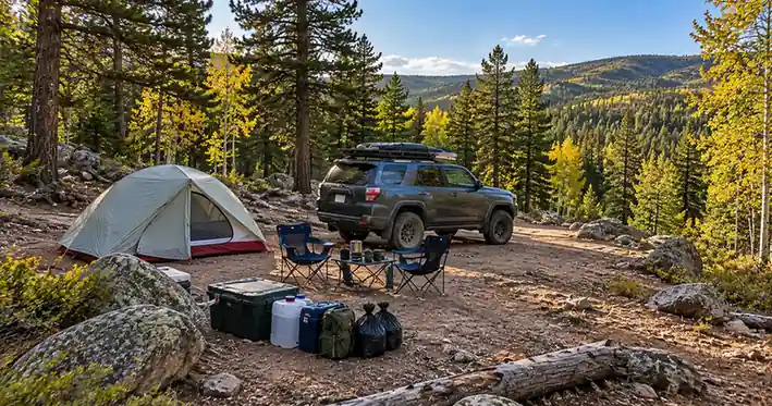
A good Gordon Gulch packing setup includes:
- Drinking and cooking water.
- Offline maps.
- Food secured from wildlife.
- Trash bags.
- Human-waste supplies.
- Weather-appropriate shelter.
- Warm layers.
- Basic vehicle-recovery equipment appropriate to your vehicle.
- A legal backup camping destination.
When to Camp at Gordon Gulch
Conditions around Nederland change substantially through the year, so there is no single season that is automatically best for every camper.
Late Spring and Early Summer
Snowmelt can leave unpaved roads wet, muddy, or rutted even when lower-elevation roads are dry.
Cold nights are still possible, and shaded sections may hold moisture longer than expected.
Verify road status before assuming spring access.
Summer
Summer generally offers the easiest window for camping, but it also brings demand, afternoon thunderstorms, changing fire danger, and the possibility of fire restrictions.
First-come, first-served sites can fill during popular periods, making a backup especially important.
Avoid arriving so late in the day that you have no daylight left to evaluate another camping area safely.
Fall
Fall can mean cooler nights, shorter daylight hours, and changing weather.
The forest around Nederland can become cold quickly after sunset, so sleeping gear appropriate for mountain temperatures matters.
Early-season snow is also possible.
Winter
Do not assume Gordon Gulch is routinely accessible by vehicle throughout winter.
The Forest Service notes that many roads across the broader forest system close or become difficult because of snow and hazardous conditions during the colder months.
Check the current road table, weather, gates, and local conditions before attempting a winter trip.
What to Do If Gordon Gulch Is Full
With only 15 designated sites and no reservations, arriving without a backup is a gamble.
If every legal site is occupied:
- Do not create a new campsite.
- Do not park on private property.
- Do not use an old campsite pin unless current rules confirm camping is legal there.
- Check your pre-researched alternative.
- Consider a developed campground when dispersed alternatives are uncertain.
- Move while you still have enough daylight to inspect another road and campsite safely.
Before the trip, plan a legal backup campsite and save its directions offline. A good backup should be a real legal overnight option rather than another unverified map pin.
Who Is Gordon Gulch Camping Best For?
The Gordon Gulch dispersed camping area CO is a good fit for campers who are comfortable being self-sufficient and do not need campground amenities.
It may suit you if:
- You bring your own water.
- You understand dispersed-camping sanitation.
- You are comfortable evaluating dirt-road conditions.
- Your vehicle is appropriate for the road you encounter.
- You can navigate using official maps.
- You are willing to use only a designated site.
- You have another legal camping option if Gordon Gulch is full.
It may be a poor fit if:
- You need a guaranteed reservation.
- You require potable water or reliable toilets.
- You are driving a large RV without verified site dimensions.
- You are uncomfortable turning around on rough forest roads.
- You expect campground-style services.
- You do not have a backup destination.
Gordon Gulch is convenient for its proximity to Nederland and Boulder, but that convenience does not remove the need for public-land camping skills and preparation.
Frequently Asked Questions
Is Gordon Gulch Dispersed Camping Free?
Gordon Gulch is widely documented as a no-fee designated dispersed camping area, and the official campsite map shows no reservation or payment system. Because the current Forest Service recreation page has been migrated and fee information can change, verify with the Boulder Ranger District before relying on no-fee status for a future trip.
How Many Campsites Are at Gordon Gulch?
The official Forest Service map for the Gordon Gulch dispersed camping area CO identifies 15 numbered designated campsites. The sites are first-come, first-served. Within the mapped designated area, use one of those legal numbered sites rather than creating a new campsite when all 15 are occupied.
Do You Need 4WD for Gordon Gulch Dispersed Camping?
Not necessarily for every part of the area, but no vehicle-access guarantee is appropriate. Forest roads can develop mud, ruts, rocks, erosion, and fallen-tree obstacles. Check current conditions and make the decision based on your exact vehicle, the road in front of you, and the numbered campsite you are trying to reach.
Can You Have a Campfire at Gordon Gulch?
Only when current Forest Service rules allow it. The normal Gordon Gulch map permits campfires when restrictions are not in effect, but temporary restrictions override that guidance. As of September 26, 2026, Stage 1 restrictions apply on the Boulder Ranger District, so campers should not plan on an ordinary wood campfire at Gordon Gulch.
Can RVs and Trailers Camp at Gordon Gulch?
Possibly, but suitability depends on rig size, current road conditions, turning room, ground clearance, and the exact numbered site. The Forest Service map does not provide complete site-by-site RV length or parking-spur dimensions, so large rigs should not arrive without a backup location with better-verified vehicle access.
Conclusion
The Gordon Gulch dispersed camping area CO can be a practical option for primitive camping near Nederland, but successful trips depend on preparation rather than simply following a campsite pin.
Use the official 15-site Gordon Gulch map alongside the current MVUM, check road and fire conditions before departure, bring your own water and sanitation supplies, respect private property, and use only a legal designated site.
Most importantly, have a second legal camping option ready. At a small first-come dispersed area, that backup can make the difference between an easy change of plans and searching unfamiliar forest roads after dark.
References:
- U.S. Forest Service — Gordon Gulch Official Designated Campsite Map — Used to verify the 15 numbered campsites, first-come status, designated-site-only rule, mapped roads, private-property areas, campfire guidance, trash rules, human-waste requirements, washing distance, and tree-cutting restriction.
- U.S. Forest Service — Arapaho and Roosevelt National Forests Current Conditions — Used to verify current Boulder Ranger District fire-danger status, Forest Service road-status guidance, and the need to check changing road and seasonal conditions.
- U.S. Forest Service — Arapaho and Roosevelt National Forests FAQs — Used to verify Forest Service guidance on dispersed-camping self-sufficiency, road variability, MVUM use, amenities, campfires, and changing road conditions.
- U.S. Forest Service — Boulder Ranger District Motor Vehicle Use Map — Used to verify Gordon Gulch-area Forest Service road designations and the role of the MVUM in legal motorized access.
- U.S. Forest Service — Stage 1 Fire Restrictions Order ARP-2024-05 — Used for Stage 1 restrictions and the rules governing gas- or liquid-fueled devices with an on/off control.
- Your Boulder — Camping Near Boulder: The Best Campgrounds and How to Book — Used only as a recent secondary cross-check for Gordon Gulch’s no-fee status, elevation, location north of Nederland, and lack of developed water, toilet, and trash services where the current Gordon-specific Forest Service recreation page was unavailable.